Drone Surveying in London | Roof & Building Inspections
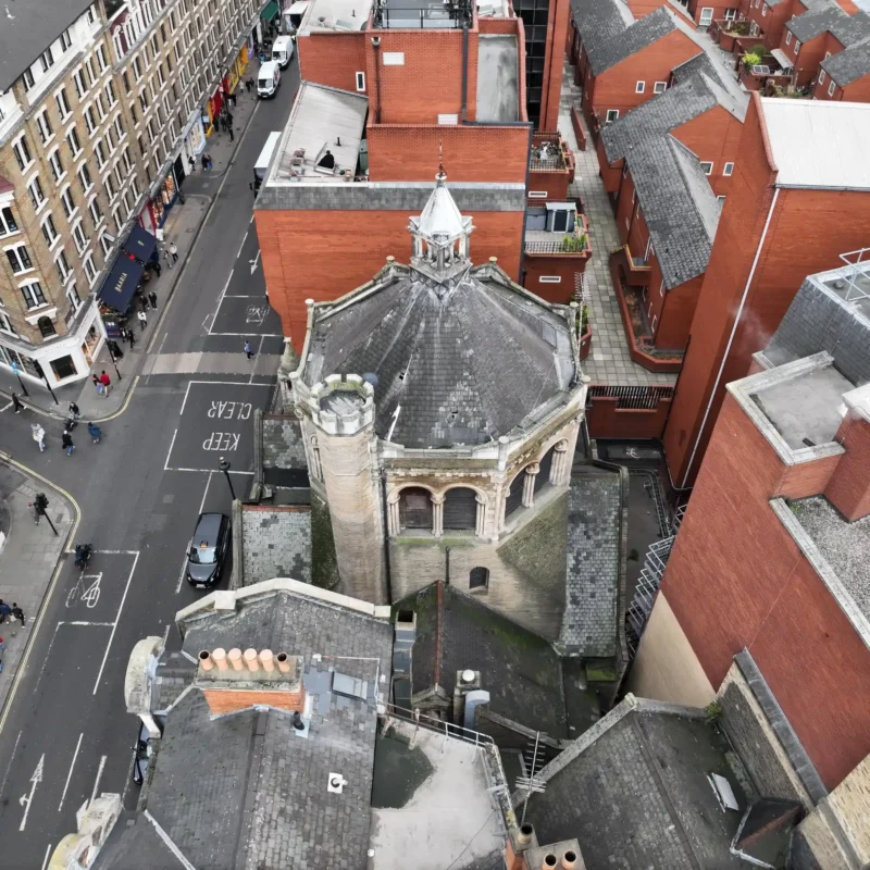
- No need for scaffolding or cherry pickers
- Reduce inspection costs by between 30-70%
- Faster turnaround times
- Improved health & safety on site
- Minimal disruption to occupants and operations
- Delivered by experienced Chartered Surveyors

- Roof & façade inspections
- Towers, chimneys & high-level structures
- Land and site surveys
- Construction progress monitoring
- Interior surveys (where access and connectivity allow)
- High-resolution photography & 4K video capture
- Condition schedules & building reports
- Planned preventative maintenance advice
- Building defect analysis
As Chartered Building Surveyors, we do not simply capture data – we interpret it and provide formal reports, defect analysis and technical advice where required (at an additional cost).
Why Adair?
- UK CAA certified pilots
- We support clients across London and the UK
- Support clients across all industries
- Over 30 years of experience in the built environment
- Public liability and Professional indemnity cover
- Follow strict privacy protocols for data capture
FAQs
A drone survey uses unmanned aerial technology to capture high-resolution imagery and data for building inspection and analysis. When carried out by chartered surveyors, this data is interpreted to support condition reporting, defect analysis and asset management.
Yes. As chartered building surveyors, we provide formal reports, defect analysis and technical advice where required. This ensures survey data is translated into clear, practical outcomes – not just imagery.
In many cases, yes. Drone surveys can remove the need for scaffolding, manned cherry pickers or access equipment for high-level inspections, significantly reducing cost, time and disruption.
Costs vary depending on the size, complexity and access requirements of the building. However, drone surveys can reduce overall inspection costs by up to 70% by minimising the need for access equipment.
Yes, when used correctly. High-resolution imagery allows detailed inspection of building elements, and when interpreted by chartered surveyors, provides reliable insight for reporting and decision-making.
No. The drone must be kept below 120m and in direct line of sight with the operator. Permission should be gained from the landowner or occupier to take off and land from the property. Drones cannot be flown in restricted airspace or in crowded areas over people. Some locations may require additional police permission.
No. Drones should not be flown in strong winds, rain or other water, snow, cold weather, fog, and sun glare for safety reasons. We closely monitor weather conditions leading up to a flight and if we must cancel will re-arrange for as soon as the weather allows.
Request a drone survey quote
Key Contacts

Manish Ranpuria

Mark Ruddell